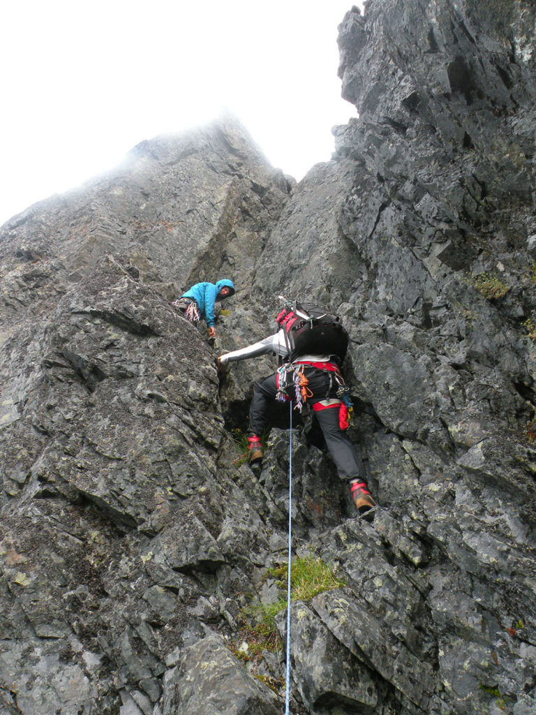
The grey clouds had been swirling about the peak all morning looking ominous so there was a feeling of resigned inevitability as the rain started to pitter patter on the dark rock around our belay. Garner Begeron and I ruminated about the prospect of rappelling back down the 300 or so metres we’d climbed up the west side of Mt Colonel Foster that morning. Not a great prospect given how far we’d come. Then we heard Hunter Lee call down that we were “on belay” so up into the drizzle we continued to climb.

Mt Colonel Foster is well known for its imposing 1000m east face. Not only is the east face covered in natural lines with imposing relief but it’s also the most accessible part of the peak, so most of the climbing has naturally been concentrated there. But Mt Colonel Foster has no shortage of eye-catching features and viewing the Island’s iconic mountain from points north the line that always seems to stand out is the northwest skyline. With each of the major buttresses and couloirs on the east face now sporting ascents interest in new climbs has turned to the less imposing but still impressive west side of the mountain. In December 2014 Hunter Lee, Josh Overdijck and I had climbed the Great West Couloir looking for a more direct line to the main summit. While bivvied below the west face that winter we were treated to an up-close view of the Northwest Arête, a striking feature that runs up to the summit of Colonel Foster’s Northwest Peak. That seed germinated in July 2016 and Hunter and I invited Garner to join us for a trip to investigate this promising feature.
The three of us began the hike up the Elk River trail on July 22 with a plan for three nights out. The trek up the valley went smoothly and in a few hours we were chatting with some local hikers at Landslide Lake as we soaked in the impressive view of the Colonel. The bushwhack of old around the shore of the lake has softened with the years as many boots have pounded in a fairly good tread and only a few stubborn slide alder stems form any kind of obstacle. What used to feel like a real chore is now little more than an extension of the main trail.
There are other changes I notice too. When I first visited Landslide Lake almost 30 years ago the aftermath of the great landslide and resulting tsunami was very much in evidence. While the story is still illustrated in the surroundings the trees have greened up around the shore, the huge logs that used to lie scattered on the scoured rock slabs have been eaten away by carpenter ants and the open rock is rapidly disappearing beneath the new forest.

We followed the usual approach line along the creek up to Foster Lake and then turned north along the moraine and up the heavily forested and bushy hillside to the high shelf north of Landslide Lake. Here a massive debris field of huge boulders that didn’t have quite enough momentum to make it to the edge and plummet into Landslide Lake sit silently in a scene that otherwise screams chaos.
It’s a bit of a scrappy scramble out of this basin up some loose choss to reach the North Col and we were all glad to see the back of that and dump our packs beside the pretty alpine pools that nestle in the high saddle.
It rained a little overnight and as we roused the next morning a dense fog hung over the mountains. No worries yet as we had more or less planned on a rest day following the approach. We took it easy for most of the day taking a couple of hours to reccie the first part of the approach which makes a descending traverse around the base of the rock faces on the north side of the mountain. My wife Renée and I had been around this route a couple of summers previously so I knew that it went. A few other climbers, including Mike Walsh on the first ascent in 1968, have used this line too and its utility is starting to grow in importance as access to and from the west face.
That evening a clearing trend set in and the temperature cooled down. Good signs for the climb the next day. We sorted the rack and ropes and made plans for a reasonably early start.

On July 24th we rose around 4 am, made breakfast and left our camp by headlamp hiking up to the North Shoulder and then making a long descent down a boulder choked creek-chute that drains the névé at the base of the North Tower (see photo above). The chute ends at a cliff edge forcing an exposed traverse westward across a slope of fine, loose talus. Once across the talus the exposure is reduced by the typical, stocky island alpine trees and the rest of the approach is straightforward traversing around the base of the upper rock face on heather and open granite ledges.
From Google Earth imagery we had a pretty good idea of how far to traverse to reach the third of three ‘stacked’ ribs that formed the base of our route. We were at the base of the Northwest Arête for 7:30 am.
We started up a wide slab of clean, solid, grey basalt, scrambling up 4th class rock to the left of a gully. Our proposed line angled right so eventually we were forced into the gully where some damp moss covered the rock. It’s every Island alpinist’s nightmare that the vegetation will be their undoing so we prudently decided to rope up.
Hunter led the charge starting with a couple of pitches up the gully. Passing a large chockstone presented some entertainment by way of a 5.7 crux. The third pitch had a tricky traverse across a slab that put us into 5.9 territory but the rock was sound and everything seemed to be falling into place. After some low 5th class we were tucked onto a small ledge below a right-leaning chimney/ramp. This is where the fog started to look a lot more like rain. Hunter pulled his hood up and headed up the ramp. Watching from below it was obviously difficult but Hunter figured it out and flashed us a big grin once over the steep head of the ramp before disappearing from view to the other side of the rib. Garner and I followed together on the double ropes and as we grappled with the 5.9 crux of this pitch voiced admiration for Hunter’s lead.

We were now on the right side of the arête and the rib was starting to narrow and take form. A 5.6 and a 5.7 pitch and more 4th class and we were getting higher and higher along the arête. As noon approached and the sun pulled over the crest of the mountain and began to warm the west side we realized that the rain hadn’t really materialized and we started to shed a few layers.
By 8 or 9 pitches up the arête was becoming quite narrow. Good on the one hand because we had hoped to find a nice aesthetic feature for our climb but some unease was peppering our conversation as we watched the deep chasms on either side steadily pinch toward our slender thread with no view past the pinnacles above us. Would our arête connect with the main summit ridge?

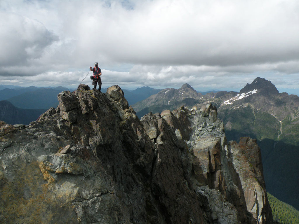
Garner led over some easy 4th class blocks and ledges on the left side of the arête. Next pitch took him onto the crest at a series of pinnacles and Hunter and I exchanged nervous glances as Garner hollered down that the other side of the arête dropped away and he couldn’t see a way forward. He back-tracked to our side and made a rising traverse below the pinnacles and went back up to the crest again. This time a whoop and a cheer! On the other side was a wide ledge. Garner belayed Hunter and I and we joined him on the ledge following its line up along the right side of the arête and smack against the summit block of the Northwest Peak.
Relieved we broke for a late lunch, finally taking the time to soak in the atmosphere of being perched high above the west coast with the sun shimmering on the Pacific Ocean and the deep green of the early summer forest laid out below.
Packed up again we scrambled up 4th class terrain over some massive boulders and met the cairns marking the summit ridge traverse. From the Northwest Peak the traverse line turns ninety degree to the right and a ledge on the north side of the ridge leads eastward to a notch overlooking the drop into the col between the Northwest Peak and the North Tower, and the first rappel station.

We rapped a line that kept to the rock well above the notorious Evacuation Gully. As the years have passed the bergschrunds in the gully snow have appeared progressively earlier in the season and while it takes more rappels to keep to the rock it is a lot safer.
The setting sun beamed across the North Vancouver Island mountains lighting up our descent in a beautiful golden glow. This is one of the hallmark experiences of a late day descent off the north end of Mt Colonel Foster and it brought back memories of past climbs on the mountain. I took the lead fixing the descent and we picked our way down making ten rappels down the rock steps, ribs and gullies toward the waiting névé below. With a stroke of impeccable timing I landed on the snow as the last of the daylight faded and once all safely off with ropes coiled and stowed we made our way by headlamp back down to our camp in the north col.
It had been a fantastic climb with just enough technical difficulty to make a worthy adventure and the up-and-over line of climb and descent leading straight back to the camp had a wonderfully aesthetic feel. For anyone looking for a stand-alone climb not needing to reach the main summit this route makes a perfect choice, although it’s totally feasible to continue south along the summit traverse to include all the main peaks if that’s your jam!
After a nice long sleep we had a casual departure from camp before making the long, familiar trudge down the Elk River trail and back home.
Northwest Arête D+ 5.9, IV 500m
FA: Hunter Lee, Garner Bergeron, Philip Stone 24 July, 2016

Note camp on lower west shoulder bottom right used for Great West Couloir.
