Climbing peaks around the Cliffe Glacier
The combination of water access and mountaineering isn’t unique to Vancouver Island but it has to be said that here on the west coast the combination is ultimately aesthetic and a pure slice of Canadiana. There’s several classic adventures that spring to mind that start on lake or ocean waters and peak on a mountain summit: Rugged Mountain via Woss Lake comes to mind, Mt McBride via Buttle Lake is pretty cool. Splendour Mountain via Matchlee Bay and so on. Add to this list Red Pillar Mountain from Oshinow Lake.
Like many peripheral corners of Strathcona Park, Oshinow Lake has seen its share of industrial activity. Looking at the boundary of the park it’s obvious, although the dates and history escape me, that the lake was cut out of the park to allow logging, doubtless for a land trade deal elsewhere, as was the way in the 1970s.
The Strathcona Park master Plan calls for putting the road access to Oshinow Lake to good use. It suggests a full Parks campground at the south end (and at Donner Lake too BTW); completion of several trails linking Oshinow Lake to Margaret Lake (and thereby Buttle Lake via Price Creek) and to the Della Falls trail. Like so many great plans for Strathcona these ideas sit idly on the backburner waiting champions and, of course, money.
A lot of effort has gone into the trail network in the area. When I hiked out from Margaret Lake on the Strathcona Centennial Expedition in 2010 we hiked part of the trail from Homasum Lake down the Margaret Creek valley and while it was clearly under-used, a lot of work was plainly evident.
The counterpart to the Homasum Lake trail which leaves the north end of Oshinow Lake, is the Red Pillar trail. None of these trails have been officially sanctioned but judging but the time, effort and use the Red Pillar route gets, that is all but a formality.
Anyway… enough of the garbled background, on with our adventure.
So Renée joined the Alpine Club of Canada Vancouver Island Section and she has a list. You know the list, the IQs. I’m a lapsed member… sad I know but I never was a club kind of person. But I do like lists! With an eye on a week in July Renée made it clear that Mt Harmston was to be the destination. I balked initially as I had dreams of a more technical nature but the more I thought about it the more I warmed to the idea.
For me I could vanquish a pair of summit demons. The Red Pillar I had climbed last in 1995 to within a small cloud and a few fading evening daylight minutes of the summit, and on Harmston I had visited the south summit but had missed the all important register on the main peak. So there was a chance to convert those near-misses into legit ascents plus add a rare visit to the adjacent Tzela Mountain and cross off another 6,000 ft Island peak off my now very short to-do list.
We left Quadra Island on the 8 am ferry. Not super early but I had to make some attempt at looking for a pair of boots in Courtenay as I’d discovered while packing that my current pair had sprung a sole. That mission turned up results. The new Valhalla store had only just opened and while they weren’t fully stocked I found a pair of light, and luckily cheap last minute replacements. Thanks Corey, Richard and the VPO team!
On to Qualicum Beach to track down Peter Rothermel and a loan of his trusty canoe. Peter was out at work when we arrived but the sturdy craft was all decked out in the backyard ready to go. We loaded it up and tied it down and then Peter’s beaming face walked down the path, early finish from work and a nice chance for a chat.
It was lunch time by the time we were in Port Alberni. It has to be said that for all the great access that Oshinow Lake provides, there is a lot of driving involved.. well I guess unless you live in Port, in which case it’s on your doorstep!
What to do when the day is already slipping by and you are in Port Alberni at lunch time? Of course breakfast at Pescadores is a must!
There’s two main road systems that leave Port Alberni northward toward Oshinow Lake. There’s the Comox Main which is found off the Beaver Creek Road from right downtown. Or there’s the Ash River road which is found by driving west on Highway 4 for 13 km or so and taking Great Central Lake road up to the lake and from there onto the Ash Main.
It doesn’t really matter which road you take. We went out on the Comox Main and came back on the Ash Road. The main thing is to have a map and watch your direction at the junction between the two. That and locating the last junction off the Ash Main to Oshinow Lake which isn’t signposted but is around Ash Main km52 and is pretty obvious as a disused road before the main line crosses the river to the west side and on toward Mt Bueby.
The rutted out road takes you several kilometres along the Ash River. Just before the lake is a short spur down to the river. We went down to have a look but it was just 100m short of the lake and although you probably could put a canoe in and drag it into the lake I remembered from a previous trip that the road does go right down to the lake side. We drove another km or so up a steep cut and sure enough there was the idyllic red-neck camp scene and boat launch at the south end of Oshinow Lake.
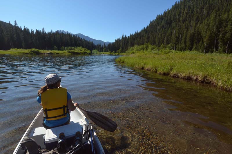
As long as this preamble is, the untying and packing the canoe was quick! We were off up the lake by about 4:30 pm and paddled for a half hour about two-thirds of the way up the lake before I realized we’d left the rope in the truck! Ack!!
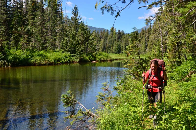
An hour later we’d paddled back to the launch, grabbed the rope and were finally paddling into the beautiful river outlet, estuary at the north end of the lake. It was a magical place. The sun was shining, the river smooth and barely flowing, lush green sedges, grasses punctuated by colourful wildflowers. It looked just like a mainland coastal river estuary and we half-expected a grizzly bear to wander into the scene! But of course it was Vancouver Island so no grizzlies and the local wildlife was probably laying low in the heat of the day. Couldn’t say the same for the bugs though. As we entered the river they started to swarm and were biting every exposed bit of us.
We brought the canoe easily up to the first rapid and pulled out on the right (east) bank. Confusingly there was only flagging visible from the water on the left (west) bank, marking the start of the Homasum (Margaret) Lake trail/route. But the Red Pillar route is on the east side of the river and we fixed up the flagging gaff by grabbing a few strands from the west side and marking the Red Pillar pull out.
By now the day was getting on so we only had time to hike an hour or so up the river course. With packs laden with a week’s food it was already tough work. We found a perfect gravel bar alongside the Ash and fought off the bugs as we pitched the tent, ate a hasty supper and crawled into our cosy, double sleeping bag.
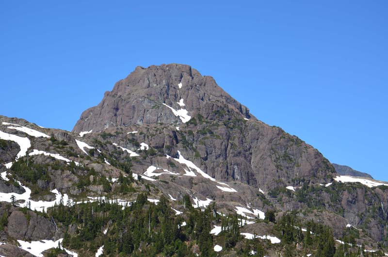
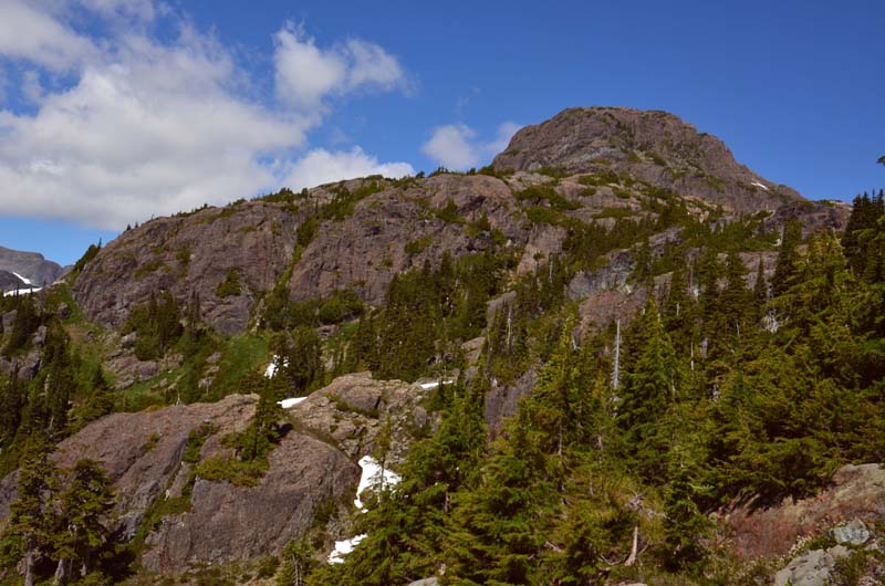
Next day we were up slowly but once underway we quickly reached the sign marking the start of the ascent up toward the Red Pillar. This ‘trail’ may not be officially sanctioned but it is everything you could wish for in a trail. Someone has clearly but an immense amount of work into the trail and it weaves up the hillside perfectly. The lake is at 450m and the trail is gentle going until about 600m. Then the hillside steepens noticeably and the hard work is between 600 and 1000m elevation. Once above that the terrain eases and the trail takes a really nice line along a sub-alpine ridge and up above the tree-line to the open alpine above Ester Lake. Above Ester Lake are the first views of the Red Pillar enticing you onward.
We didn’t have a concrete plan for where to go but both of us were groaning under the weight of out packs. I had sort of fantasized about climbing the northwest ridge on Mt Harmston and I knew to do that we would need to be camped at least on the west shoulder of the Red Pillar or ideally down at the snout of the Cliffe Glacier. But after dragging that brute up to the alpine I didn’t protest much as Renée made it clear she wasn’t moving camp past Peak 1712.
This was her trip so i was totally fine with that and we settled in to a nice heather nook out of the wind – as we had an eye on some very black clouds billowing up to the south.
We were treated to a spectacular sunset light show and Renée was especially taken with the looming clouds over the Alberni valley. Luckily I took their threat seriously enough to make sure camp was all secure for the night because around 2 am it started pouring with rain. Not just any old rain but you know, hard west coast, ‘I’m gonna flush you off the mountain’, rain.
Needless to say we kept sleeping, snoozing as the rain continued, not once poking outside the tent. When finally it stopped and I could hold my bladder no longer I un-zipped the tent to dash out and discovered my camp-Crocs floating outside the tent door. Uh-oh!! Not that old scenario again, the flooded camp!
Didn’t turn out to bad and once the food was rescued and the low wet spots identified we were still dry in the tent and we knew the forecast was for sun, sun, sun so no biggie. Still the clouds weren’t in a hurry to leave so we goofed around camp until late morning and it looked like things were settled enough to make a go for the Red Pillar.
From our camp at Peak 1712 it was a short drop into a col at the base of the Red Pillar’s south ridge. A long but easy traverse across the south west side of the ridge on wide open snow slopes took us to a higher col at the toe of the south ridge proper.
We stopped for lunch and to case out the route. We had plenty of beta from online trip reports and knew to look for a long rising traverse edge which was easy to see from below. We could see tracks from a group a few days before, Lloyd Lowe and his team I knew from Lloyd’s FaceBook post.
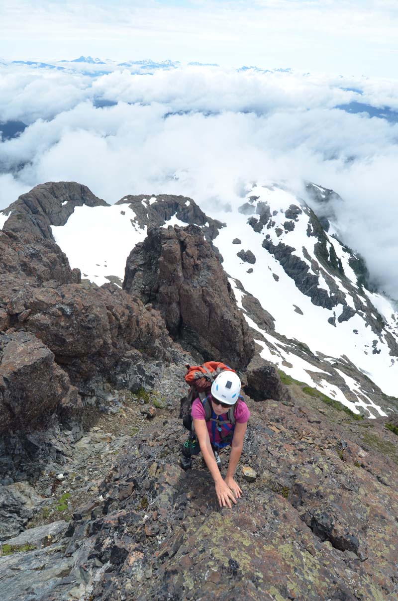
After lunch we started up an easy and gradually steepening snow slope to the right of the ridge crest. Stepping off the snow onto a rib of heather, rock as the snow got uncomfortably steep we hit a ledge rimmed by weathered crumholz and followed it to the left (west) side of the ridge. The ledge butted up against a steep step which we scrambled over at 3rd class and found the ledge continued rising up and to the left taking us way up the side of the pillar.
Gradually the ledge narrowed until we were standing at the end of it at the base of a low angle fin of red basalt and a drop into a deep gully. Renée consulted the route description I had distilled from Quagger’s write-up at IslandHikes.com but we had a tough time deciding whether to head up the first easy gully or make a dicey downclimb to reach a further gully. Eventually common-sense prevailed and we took the first easy gully that ran up behind this cool looking fin. If you were psyched for it the fin would be a great option too as it easily joins the gully higher up.
So a bit of class 2+ rubbly gully choss took us up to a little notch right on the crest of the south ridge. We could see a rappel sling leading down the gully on the other side. Above was some nice 4th class scrambling on decent rock in a gully/chimney feature. A couple of exposed moves near the top made for some good value. This put us at yet another little col, notch feature between gullies on the southeast and west sides of the mountain.
The next part looked complicated but turned out to be very straightforward and simply involved walking across the top of gullies on the west side of the peak, ascending where possible. One gully had distinctive find-grained white granite boulders and this led to the summit plateau.
There’s a few cairns on the top plateau. The actual summit is usually covered in a cap of snow and the register is kept in a lower cairn at the top of the west ridge. Probably because traditionally the west ridge was the standard route.
Clouds swirled around the peak and we hung out an hour or more while we enjoyed the view and I waited for that all important photo of the south east side of Argus Mountain to show the low traverse route around that peak!! Always collecting beta!!
Once satisfied with the photos and with evening drawing we downclimbed the same line and were back in camp for supper time and another spectacular sunset show.
Next day we planned to truck over to Mt Harmston and figured we’d need an early start so we packed our gear and more-or-less organized our food for the day before crashing.
Up next day as the sun hit the tent and we were off down to the first little col. Renée was a little hesitant about crossing the snow on the west side of the Pillar so we decided to descend into the base of the west cirque and take a low-angle bench we could see back on to the lower west ridge. This all worked out fine but we couldn’t commit to dropping off the other side and ended up ascending the west ridge all the way up to the west shoulder of the Pillar before we could get onto the Cliffe Glacier.
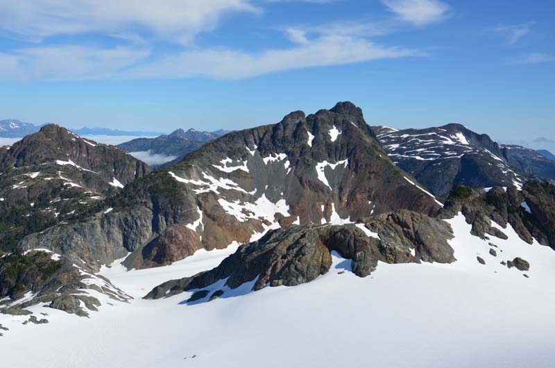
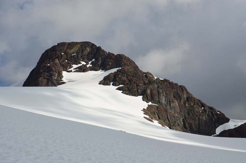
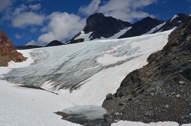
We roped up for the glacier crossing and dropped onto the expansive nevé. Super fast travel down the glacier to the little alley-way that connects the upper Cliffe Glacier between Argus Mountain and the Red Pillar and the lower glacier between Argus and Mt Harmston. I regained my respect for the Cliffe Glacier, on the map it seems so small but once standing in the middle of it it seems a long way across!. Small glacier but you wouldn’t want to mow it!
There’s negligible elevation change between the end of the connecting alley and the col at the toe of Mt Harmston’s south east ridge. We bee-lined across the glacier and then struggled up the choss pile talus to a nice heather covered ledge at the bottom of the ridge for lunch at about 1600m.
After lunch we hiked directly up the ridge keeping to the right side on more open ground and avoiding the crumholz to the left (south) side. It all went smoothly, the little talus we had to ascend wasn’t too loose and really the bulk of the climb is a good-old-fashioned slog up to the base of the final summit block.
At the summit block of black basalt there is a 80m gully that leads up to the top, 3rd class. No great shakes and not any decent climbing moves or situation.
Luckily the views are spectacular because the ascent is hoh-hum. Worth noting that at the base of this last gully if you head out to the left (south) there is a notch on the ridge that leads easily onto the west glacier for access down to Tzela Mountain and points west and south.
Renée called her daughter from the summit which was pretty cool. There was a fair bit of convective cloud partially blocking the views in any direction so we didn’t hang around too much and then downclimbed the gully and headed back across the glacier. Oh and then back UP the glacier. The west shoulder of the Pillar is at 1800m so there’s no slacking to get back to camp on Peak 1712.
I was disappointed we hadn’t found time to visit Tzela Moauntain. I’d packed a fair load in anticipation, stove, surprise bivvy stuff, a supper etc… But as we neared camp Renée suggested I go myself the next day. Slogging back up to the shoulder wasn’t exactly inspiring to think of doing that at the end of two days in a row but I let the idea germinate a little and by the time we eating supper and the pain of that slog had faded I was already organizing a lighter pack for a dash to Tzela.
The sun was well up by the time I left Renée for her ‘holiday’ day at camp, I guess it was after 9 am by the time I was traversing the west snow slopes of the Pillar. No detour this time, straight across to the west shoulder and down the Cliffe Glacier to the snout and the outlet of the Ash River. So cool how our Island mountain adventures revolve around the topography of the rivers. As much as we love the mountains it in many ways is the rivers, well the water really in the form of rivers, glaciers and.. umm rain, that shape it all.
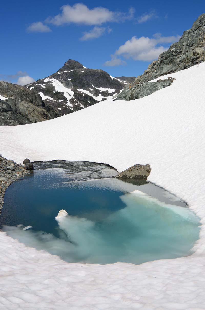
On the Harmston side of the Cliffe Glacier snout is a nasty looking grey slope of rock and muddy, moraine rubble. I could see some heather green here and there but it really wasn’t appealing. Looking down the little river canyon though looked very enticing. There was a pretty little pond of glacial silt and then the canyon was mostly a flat snow bottom until it dropped off down to Tzela Lake. A quick check of the map showed there should be an easy line out of the lower canyon into the basin southeast of Tzela Mountain so I headed down the canyon.
Sure enough this line worked out beautifully. An easy steep hike up a slope of incredible wildflowers lead around the base of Mt Harmston’s south ridge and along the base of the ridge’s bluffs on heather and into the wide open pass between Harmston and Tzela Mountain for lunch time.
Above the pass the route looked good but i could see higher up there was a very definite cliff band right across the east ridge of Tzela Mountain. Then almost right above the pass I reached a lower bluff. For a minute it had me puzzled until I looked left and saw a rising ledge system that lead to easier ground. Up heather slopes and around little bluffs until at 1700m I was at the base of the prominent cliff I had been fearing. No stranger to climbing I wasn’t prepared to be put off by this small peak but for the life of me I couldn’t see a line I liked the look of at all. Especially being there on my own without someone to bounce ideas off.
I looked out to the right and saw a very steep and exposed snow gully. That wasn’t going to work. Maybe with crampons. But solo with an axe and pair of high-top trail boots..? Nope. Directly up looked possible, I could see it working, there are ramps and bushy ledges and for sure there’s a line to use but nothing called me up.
What to do? Well if in doubt.. traverse…
So I headed around to the left toward the south side of the mountain under the base of this cliff band. As I rounded a ridge, I guess it would be the south east corner of the peak, I could see a traverse band of scree running way across the south flank of the mountain. I followed it, passing the base of a very prominent, green, vegetated gully (note to self..) and then to a second steeper gully with an amazing crossing. By now I was looking up the south west side of the peak with still no line luring me up. So I back-tracked to the prominent green gully and headed up it.
Steep easy heather led to a wall of mountain hemlock crumholz. There I was on near vertical heather with an impenetrable wall of bush above my head. What kind of a mountain is this? I inched up on the heather and pushed my back against the righthand rock wall of the gully and grabbed for a hemlock branch. I tried to pull it out to the left to open a gap for me to squeeze up into. Inches.. inches.. The branches were like spring steel, I had to use 50% of my strength to push them aside to make enough room for me, obviously the rock had no give. Finally I was in the crumholz, wedged between the branches and the rock, well at least now I can’t fall!
A few more pushes and dragging my snagged pack and poles and I was through! Good grief! easy ground up the gully and I was on a strangely flat ridge crest. It doglegged to my left and I followed around the top of the huge steep gully, cirque on the mountain’s north east side. Easy walking up and right, above the cirque led to another bluff…. seriously?
At a high point on the heather I could see a weakness but immediately I knew it was a 5th class ‘weakness’. Only 40m from the top I was loath to be deterred now.
I put my poles down and stepped up to have a look. Okay, I can do that… and down? yes. I was determined. I could see faint signs of previous climbers, not much but enough clues to know others had come this way.
First moves were up that perfect red, weathered basalt. Steep but in balance moves. 5.6, maybe just 5.5, who’s counting? Oh.. a side pull! That helped with the traverse move right I had to make to get to the next step. now more exposed. Onto some of the black basalt. Couple more moves and pheww!! easier ground. A bit of 4th class above and there was the top and a surprisingly impressive summit cairn. Do druids live up here?
Well someone must be building cairns because a quick look in the summit register and it obviously wasn’t the hoards of Island alpinists! Just two entries since 2009. Peter Rothermel & Tak Ogasawara who delivered the register, and Randy Davis and his buddy in 2010. Now me. I chuckled about Peter’s register remarks on the route.. no doubt!!!
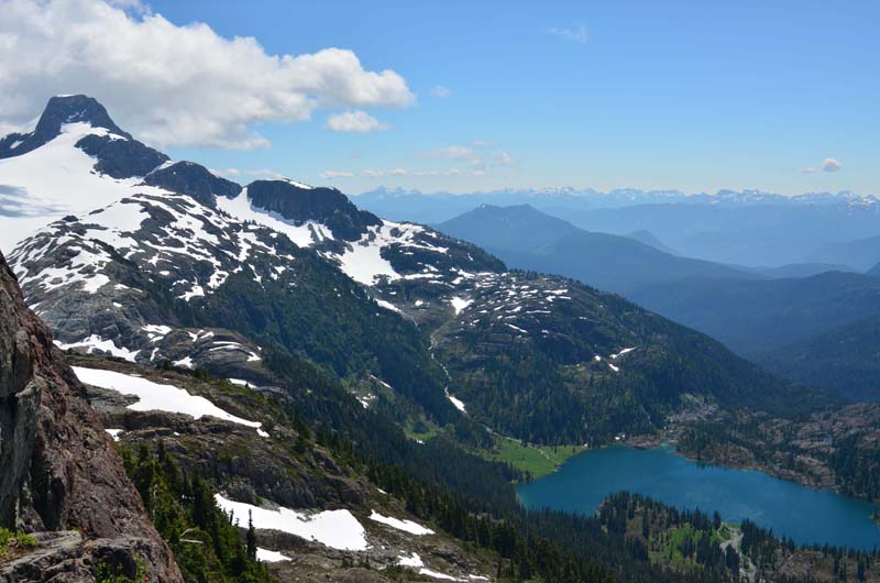
The views of Tzela Lake from this peak are unbelievable. Have to say top ten Island views. As remote as it is and as overlooked as it is, outshone by its big brothers to the east Tzela Mountain is a little gem. And for the tick listers, it is over 6,000ft so sooner or later you know you have to go!!!
Okay, so back to the descent…! What to say, it worked out. Turns out there’s a secret undercling for the traverse moves on the way down. Side pull going up – undercling headed down.. check.
Of course dropping through the gully crumholz was a lot easier on the way down and before I knew it I was back in the Tzela-Harmston col filling my water and having a snack. I was curious about trying a different way back to the Cliffe Glacier. This account is already longer than it should be so I’ll quickly say that I ascended a little out of the col onto Harmston’s south ridge. There is a line from higher up on the ridge back into the Cliffe but once on the crest I realized it was way higher than I needed to go so I hiked down the ridge to the last edge above the snout. Remember that grey, rock, muddy moraine choss I mentioned? Well yes you can get down it, (or up I suppose). Is it nice? Would I recommend it? no and no. In fact it is totally scary. Downclimbing hard-packed gravel along water runnels with perched boulders all around you feels like travelling through a steeply angled minefield where you have to step on the mines to get to the next one. If you go there remember, friends don’t let friends cross moraine mud.
Really the trip is coming to a close. You know the story now. Yes I made it off the moraine slope from hell and down to the glacier. Then up the glacier to the Red Pillar west shoulder and back to camp. Renée had had a great relaxing day on her alpine beach, finally getting her holiday moments, and had supper ready to serve as I arrived back at camp.
We hiked back down the trail to the canoe the next day to waiting beverages, a nice refreshing swim and enjoyed a lovely return trip down the lake.
Back in Qualicum we had a good chuckle with Peter about Tzela Mounatin as we dropped of the canoe and shared stories of the great adventures from Oshinow Lake.

