Warden Peak – trip report 5-7 July 2013
Warden Peak is a bit of an odd mountain. Odd as in unusual and a little bit odd as in totally overshadowed by its ‘parent’ summit Victoria Peak. It’s also odd in that information seems pretty scant on how to go about climbing to its summit.
The entry in Island Alpine is pretty basic and as I hadn’t climbed Warden peak myself I couldn’t totally vouch for it (though I do have faith it came from a reliable source) – but as it turns out it is succinct but accurate.
Renée has totally got it in for the ACC Island Qualifiers so Warden has become a ‘list item’ for her. And as I mentioned, I hadn’t climbed Warden before so I was easily persuaded to plan a trip to climb it.
A few weeks before we were to head to Warden I saw a post on the Island Climbing Facebook page from Brandon Hopkins mentioning that logging road branch WR 380 had been extended higher and included a Google Earth image showing the new spurs. WR 380 basically switchbacks up the lower forested and previously forested part of Victoria peak’s west ridge. Makes sense that WR 380 is the go to road access for the North, and West faces and as it happens, Warden Peak.
Renée & I drove up the White River main from Sayward on a Friday morning, getting to the high end of WR 380, at 1000m, for a late lunch. We finished the last bit of packing and ate lunch. Luckily there was only about 75m of slash to cross from the end of the road into the old growth so it was a mercifully short bash across the hot, dry clearcut to the cool shady forest.
The grade of the hill beyond the cut block is quite steep with a small band of rock bluffs, so we traversed 100m across the hill to the crest of the west ridge and then headed up hill.
There is bush! the route from the end of WR 380 is at the perfect elevation for the finest collection of shrubbery. So it’s uphill against a tide of blueberry and false azalea. Luckily the climb from the road to our intended camp is short, only 300m. There’s a little knoll on the west ridge with open meadows, lots of water and a great view of Victoria, Warden and the surrounding Sutton Range peaks.
We crashed in a lovely flat patch of heather and set up camp. A very easy day into the alpine!
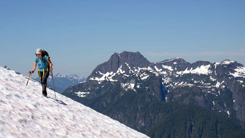
Next day we were out of camp by 8 am and dropped 100m north toward the lake nestled at the foot of the Victoria Glacier cirque. We traversed around the hill above the lake and into an open meadow half full of snow and lush heather and alpine flowers. The climbing begins easily enough up a gentle snow or talus slope at the far north side of the meadow. Ribs of old moraine lead up to the bank of the main creek gully draining the glacier. We hiked up surprisingly firm gravel alongside the creek, crossing once to the north bank. We hit snow in the gully at about 1300m and booted straight up it.
Just below the exposed blue-ice seracs of the glacier there’s a wide level bench of snow and rock slabs at 1500m breaking out to the left (north) and we made a long traverse across it and an easy drop into the huge long gully that parallels the base of Warden Peak’s west ridge. A long slog up the snow gully brought us up to the Warden-Victoria col and our first glimpses of the views to the south.
We stopped for a break and lunch on the knoll just south of Warden. The views of Victoria, Warden are spectacular from there.
After a nice break we headed for our day’s summit.
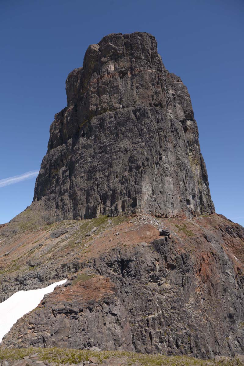
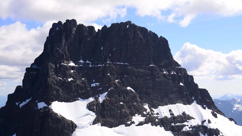
From the knoll there’s a short drop into a small col and then a short step up onto a prominent, angled scree/snow slope, the rock is rusty brown, in contrast to the black of the summit tower. We walked straight around on a traverse along this rusty ledge and across an exposed snow patch to the base of a gully between Warden and the lower sub-summit to the northwest. There was only a tiny bit of snow left in the gully and luckily presented no problems.
We scrambled up a few easy ledges to the left of the base of the gully until it steepened and we decided to set up a belay. I led up straight into the gully and found a series of broken flakes on the left to get by a steep step and detached block of snow. Above the flakes a ledge leads easily into the back of the gully and a cool squeeze behind a pair of lodged chockstones at the top of the gully which by here has narrowed to more of a chimney. I wriggled behind the chocks and then made a short scramble to exit onto a roomy but narrow col at 1900m that drops off steeply on the opposite, north side.
Renée followed and joined me at the col and took the belay up to the summit side of it. I traversed out from the col on a smooth, clean wall with great ledgey holds to the edge of a snow patch that divided this part of the face. I choose a spot where the snow was at its narrowest. Grabbed my ice tool and made four or five quick steps across the snow back onto the rock on the other side.
From here we could see two sets of rappel slings up an easy looking gully and I carried on up into the gully to one of the slings to belay. Renée quickly joined me and I ran out one more easy 4th class pitch to the summit crest.
We hung out at the summit taking in the views and reading the one entry in the register.
It took three half rope rappels to return us to the col and then two more half rope rappels down the gully and back to the easier ground on the rust belt.
Once we had the rope coiled and climbing gear packed away we began the hike back down. We had a cute encounter with a ptarmigan mother and her clutch of very new looking chicks. She stayed motionless the whole time while the chicks chirped and scurried out of our way.
A long snow descent went very smoothly and quickly. From the meadows in the bottom of the cirque we had the short bushy climb back to camp. A good full day and a great island summit.


